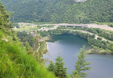
Trail Mountain bike Le Poizat-Lalleyriat - Espace VTT FFC du Bugey - Circuit n° 08 - Le Poizat - Photo

Espace VTT FFC du Bugey - Circuit n° 08 - Le Poizat

 tracegps
tracegps

User

© OpenStreetMap contributors
Length
Length
28 km
Max alt
Max alt
1200 m
Uphill gradient
Uphill gradient
762 m
Km-Effort
Km-Effort  
38 km
Min alt
Min alt
759 m
Downhill gradient
Downhill gradient
762 m
Boucle
Boucle
Yes
Creation date :
2014-12-10 00:00:00.0
Updated on :
2014-12-10 00:00:00.0

(0 Reviews)

Mountain bike
Mountain bike
2h30
Difficulty : Very difficult

Scan this QR Code to open this trail in the SityTrail application

FREE GPS app for hiking

Logo SityTrail SityTrail

IGN / Geographical institutes

Download SityTrail from the App Store Download SityTrail from Google Play

Logo SityTrail SityTrail World

The world is yours!

Download SityTrail from the App Store Download SityTrail from Google Play Download SityTrail on Huawei AppGallery

About

Trail Mountain bike of 28 km to be discovered at Auvergne-Rhône-Alpes, Ain, Le Poizat-Lalleyriat. This trail is proposed by tracegps.

Description

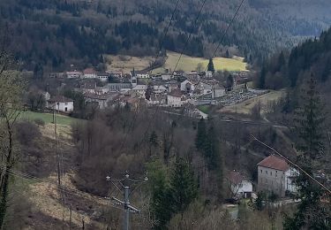
Espace VTT - FFC du Bugey - circuit n° 08. Circuit labellisé par la Fédération Française de Cyclisme. Au cœur du département de l'Ain, sur les terres du Haut-Bugey, le Plateau d'Hauteville offre une situation privilégiée. Ce Plateau de moyenne montagne offre une qualité de vie véritablement exceptionnelle, l'air pur, la nature généreuse, les bienfaits climatiques, les paysages variés, la végétation préservée étonnent... Les grandes agglomérations de Lyon, Genève, Annecy, Aix-les-Bains, Bourg-en-Bresse et Chambéry sont à une heure !

Elevation profile

Photos

Positioning

Country:
France
Region :
Auvergne-Rhône-Alpes
Department/Province :
Ain
Municipality :
Le Poizat-Lalleyriat
Location:
Unknown
Start:(UTM)
708178 ; 5113651 (31T) N.

Trails nearby

Trail Walking Le Poizat-Lalleyriat - Le poizat - Photo
Walking
loca.yves

Walking

Easy
Le Poizat-Lalleyriat, Auvergne-Rhône-Alpes, Ain, France
10.1 km | 14 km-effort
3h 38min
Yes
Trail On foot Charix - Le Tour du Plateau 6 - Photo
On foot
GUIDE+

On foot

Medium
Charix, Auvergne-Rhône-Alpes, Ain, France
17.2 km | 24 km-effort
5h 25min
Yes
Trail On foot Charix - Tour du Crêt Torcet - Photo
On foot
GUIDE+

On foot

Easy
Charix, Auvergne-Rhône-Alpes, Ain, France
12.4 km | 17.7 km-effort
4h 1min
Yes
Trail On foot Charix - Les Ruines de la Serra - Photo
On foot
GUIDE+

On foot

Easy
Charix, Auvergne-Rhône-Alpes, Ain, France
3.4 km | 4.3 km-effort
58min
No
Trail On foot Charix - Tour de Saint-Amand - Photo
On foot
GUIDE+

On foot

Easy
Charix, Auvergne-Rhône-Alpes, Ain, France
3.9 km | 5.4 km-effort
1h 14min
No
Trail Walking Saint-Germain-de-Joux - marmites Saint Germain de joux - Photo
Walking
colomb24

Walking

Medium
Saint-Germain-de-Joux, Auvergne-Rhône-Alpes, Ain, France
12.4 km | 20 km-effort
4h 51min
Yes
Trail Snowshoes Haut Valromey - la chapelle la CIA merlogne - Photo
Snowshoes
loca.yves

Snowshoes

Easy
Haut Valromey, Auvergne-Rhône-Alpes, Ain, France
7.7 km | 9.9 km-effort
2h 36min
Yes
Trail Snowshoes Haut Valromey - raquettes chapelle5km6 - Photo
Snowshoes
loca.yves

Snowshoes

Easy
Haut Valromey, Auvergne-Rhône-Alpes, Ain, France
7.9 km | 10.5 km-effort
3h 16min
Yes
Trail Walking Valserhône - Cuvéry  - Photo
Walking
sandrine-s01

Walking

Very easy
(1)
Valserhône, Auvergne-Rhône-Alpes, Ain, France
6.4 km | 8.8 km-effort
1h 51min
No


Close
My subscriptions